A new integrated search interface will become available in the next phase of marineinfo.org.
For the time being, please use IMIS to search available data
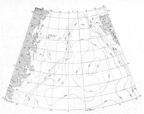
 Description Een bathymetrische kaart van de Groenlandzee, waarbij alles puntjes de nieuwe peilingen aanduiden die uitgevoerd werden aan boord van de Belgica in 1905 en 1909.JPG file - 2.22 MB - 2 945 x 2 334 pixelsadded on 2015-09-02190 viewsFrom reference Pergameni, Ch. (1935). Adrien de Gerlache: Pionnier marit...From reference VLIZ Wetenschatten (2015). Het poolschip Belgica - Histor... Click here to return to the thumbnails overview |