Here you can search in all of the data we have in our marine catalogues
*A new integrated search interface will become available in the next phase of marineinfo.org.
For the time being, please use this page as the search interface.
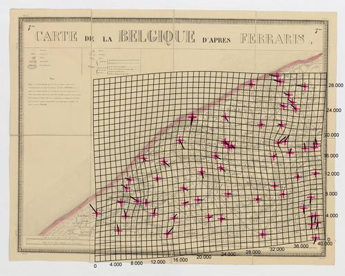
 Carte de la Belgique d'après Ferraris, augmentée des plans des six villes principales et de l'indication des routes, canaux et autres traveaux exécutés depuis 1777 jusqu'en 1831. 42 feuilles. II Description The distortion grid and the displacement vectors provide a representation of the geometric accuracy of the map and were generated using MapAnalyst (Jenny & Hurni 2011).JPG file - 3.22 MB - 5 000 x 3 987 pixelsadded on 2017-01-05370 viewsMap based on Jenny, B.; Hurni, L. (2011). Studying cartographic herita...Bruges This work is licensed under a Creative Commons Attribution-NonCommercial-ShareAlike 4.0 International License Click here to return to the thumbnails overview |
