A new integrated search interface will become available in the next phase of marineinfo.org.
For the time being, please use IMIS to search available data
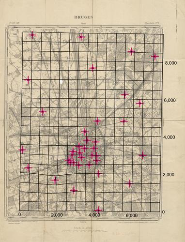
Bruges - Topografische kaart van Brugge en omgeving op schaal 1/20 000 Description The distortion grid and the displacement vectors provide a representation of the geometric accuracy of the map and were generated using MapAnalyst (Jenny & Hurni 2011).JPG file - 5.09 MB - 5 000 x 6 547 pixelsadded on 2017-01-18311 viewsMap based on Jenny, B.; Hurni, L. (2011). Studying cartographic herita... This work is licensed under a Creative Commons Attribution-NonCommercial-ShareAlike 4.0 International License Click here to return to the thumbnails overview |

