A new integrated search interface will become available in the next phase of marineinfo.org.
For the time being, please use IMIS to search available data
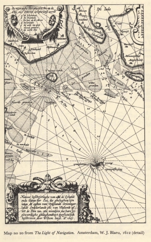
Blaeu (1612, kaart 01) Description Nieuwe beschryvinghe van alle de Eylande ende Gaten der Zee, die gheleghen zyn langs de custen van Vrieslandt Groeninger landt Embderlandt etc van Vlielandt oa tot de Elve toe, nu nieulycx na hare jegewoordighe gheleghentheyt perfectelyck beschreven door Willem Iansz a° 1607
Benaminghe der plaetsen die op de Elve met letteren aenghewese werde
A. De Schortonne
B. De Rostonne
C. De ton op de Meem
D. De Grutpot
E. De witte ton op de nieuwe gronden
F. De noord ElveDatum: 1607Plaats: DuitslandJPG file - 1.03 MB - 1 380 x 2 222 pixelsadded on 2011-08-101 816 viewsFrom reference Skelton, R.A.; Blaeu, W.J. (1964). The Light of Navigatio... (page [11])Click here to return to the thumbnails overview |

