A new integrated search interface will become available in the next phase of marineinfo.org.
For the time being, please use IMIS to search available data
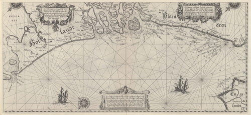
Blaeu (1612, kaart 04) Description Pascaarte van Hollandt Zeelandt ende Vlaenderen, van Texel af tot deur de Hoofden, toonende de rechte gheleghentheyt aller gaten, Zanden, bancken, diepten ende ondiepten aldaer gheleghen, nieulycx beschreven door Willem Ianzs = Carte marine de Hollande Zeelande et Flandres, de Texel iusques au Pad e Calais, mostrant la vraye situation des Ports de mer, bancqz de sable, profonditez, et seicheresses situez au long des costes desdictes Cotreez, novellement descript per Guillaume IanszDatum: 1612Plaats: Vlaanderen, NederlandJPG file - 3.84 MB - 6 638 x 3 050 pixelsadded on 2011-08-102 224 viewsFrom reference Skelton, R.A.; Blaeu, W.J. (1964). The Light of Navigatio... (page [84])Click here to return to the thumbnails overview |

