A new integrated search interface will become available in the next phase of marineinfo.org.
For the time being, please use IMIS to search available data
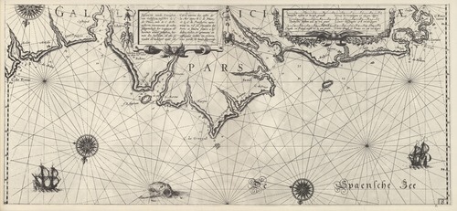
Blaeu (1612, kaart 10) Description Pascaarte vande Zeecusten van Galissien, tusschen de C. de Pinas, ende de C. de Finisterre, vertoonende de rechte gelegentheijt der zeegaten en havenen aldaer geleghen, hoemen die bezeijlen, en alle periculen en ondiepte mijde sal = Carte marine des costes de la Mer entre le C. de Pinas, et le C. de Finisterre, monstrant au vif la situation des Ports et baures sitnez a lesdictes costes, et comment en costoyant icelles on evitera tous perils et lieux dagereuxDatum: 1612Plaats: Noord-SpanjeJPG file - 4.09 MB - 6 666 x 3 075 pixelsadded on 2011-08-111 444 viewsFrom reference Skelton, R.A.; Blaeu, W.J. (1964). The Light of Navigatio... (page [138])Click here to return to the thumbnails overview |

