A new integrated search interface will become available in the next phase of marineinfo.org.
For the time being, please use IMIS to search available data
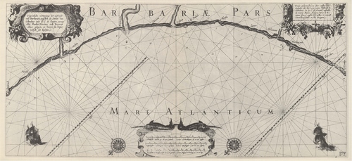
Blaeu (1612, kaart 14) Description Eijgentlijke vertooninge der westcuste van Barbarien, tusschen de Strate van Gibraltar ende de C. de Cantin, zampe aller Reeden Havenen ende Rivieren aldaer gelegen, en hoemen die bequamelijck sal beseijlen = Vraije pourtraicture des costes occidentales de Barbarie, entre l'estroict de Gibraltar et le C. de Cantin, ensemble de toutes Rades, Haures, Ports et Rivieres situez ausdictes costes; et commet commodieusement on les navigeraDatum: 1612Plaats: Iberisch-Marokkaanse GolfJPG file - 3.31 MB - 6 663 x 3 050 pixelsadded on 2011-08-111 793 viewsFrom reference Skelton, R.A.; Blaeu, W.J. (1964). The Light of Navigatio... (page [162])Click here to return to the thumbnails overview |

