A new integrated search interface will become available in the next phase of marineinfo.org.
For the time being, please use IMIS to search available data
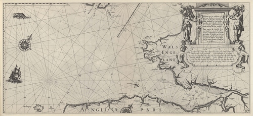
Blaeu (1612, kaart 019) Description Pascaarte van het vermaert Canael van Briston, ertoonende aet zuijden de Zeecusten achter Engelat, vande Sorlinghes af tot Bristou toe, Item aen't Noorden de Custen van bijna geheel Wals Engelandt, met een deel van Yerland = Carte marine du canal de Bristou, monstrant au Su les costes marines d'Angleterre de les Sorlinges iusques a Bristou au Nord quasi toutes les costes de Wallie, et aussi une partie de Irlande, le tout dress' selon les vraijes elevations de pole, routes et distancesDatum: 1612Plaats: Wales, Sint-Georgekanaal, Zuid-West EngelandJPG file - 3.65 MB - 6 671 x 3 073 pixelsadded on 2011-08-111 923 viewsFrom reference Voogt, C.J.; van Keulen, G. (1728). De Nieuwe Groote Ligt... (page [183])Click here to return to the thumbnails overview |

