A new integrated search interface will become available in the next phase of marineinfo.org.
For the time being, please use IMIS to search available data
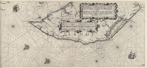
Blaeu (1612, kaart 24) Description Ware afbeeldinge der Zeecusten vant noorder deel van Jutlandt vanden doodenbergh af tot om den hoeck van Schagen, tonende hoemen die selve beseylen, en de ondiepten daer neffens gelegen schouwen sal = Vary pourtaict des Costes marines de la partie Septentrionale de Jutlande, commencant du mont dict doodenbergh jusqu'a 'l'entour la poincte de Schagen, monstrant comment on les navigera et evitera les gues y environDatum: 1612Plaats: Noord-JutlandJPG file - 3.49 MB - 6 621 x 3 071 pixelsadded on 2011-08-111 026 viewsFrom reference Skelton, R.A.; Blaeu, W.J. (1964). The Light of Navigatio... (page [233])Click here to return to the thumbnails overview |

