A new integrated search interface will become available in the next phase of marineinfo.org.
For the time being, please use IMIS to search available data
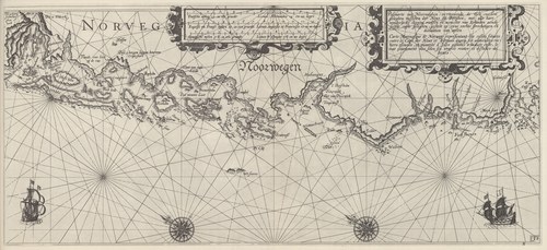
Blaeu (1612, kaart 33) Description Pascaarte van Noorweghen, vertoonende de Zee-custen geleghen tusschen der Neus en Berghen, met alle hare wonderlycke clippen rudsen en menichte van Eylanden aende selfde custe geleghen, gestelt op zyne rechte streckingen en distantien van mylen = Carte Marinesque de Norwege representant les costes situees entre le Cape der Neus et Bergues auecq ses admirables rochiers escueilz, et quantité d'Isles gisantes a la dicte coste, le tout exactement mis selon ses vrayes routes et distance de lieuesDatum: 1612Plaats: Zuid-NoorwegenJPG file - 4.05 MB - 6 650 x 3 043 pixelsadded on 2011-08-121 252 viewsFrom reference Skelton, R.A.; Blaeu, W.J. (1964). The Light of Navigatio... (page [293])Click here to return to the thumbnails overview |

