A new integrated search interface will become available in the next phase of marineinfo.org.
For the time being, please use IMIS to search available data
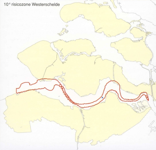
Risicocontouren, 10-6 risicozone Westerschelde Description De plaatsgebonden 10-6-risicocontouren (zie tekst) voor calamiteiten door scheepsongevallen op de Westerschelde van voorheen (rood) en nu (blauw) (richtjaar 2003).JPG file - 351.99 kB - 1 088 x 1 047 pixelsadded on 2009-07-28413 viewsFrom reference (2004). Schelde Nieuwsbrief 41. Schelde Nieuwsbrief, 41[s...Graph from Risk contours, 10-6 risk zone Western ScheldtClick here to return to the thumbnails overview |

