A new integrated search interface will become available in the next phase of marineinfo.org.
For the time being, please use IMIS to search available data
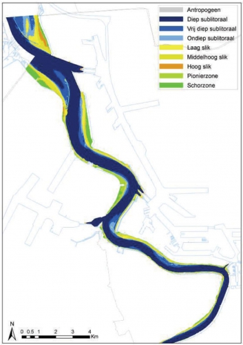
Ecotopenkaart Zeeschelde (gebied Haven van Antwerpen, 2004). Description De volledige kaart is te consulteren via de indicatorpagina: http://www.scheldemonitor.be/indicatorfiche.php?id=8. De detaildata die deze kaart onderbouwen, zijn medio 2010 nog niet publiek beschikbaar maar worden vermoedelijk
toegankelijk in 2010. Bron: Instituut voor Natuur- en Bosonderzoek. · Click here to return to the thumbnails overview |

