A new integrated search interface will become available in the next phase of marineinfo.org.
For the time being, please use IMIS to search available data
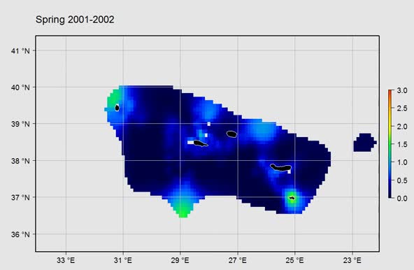
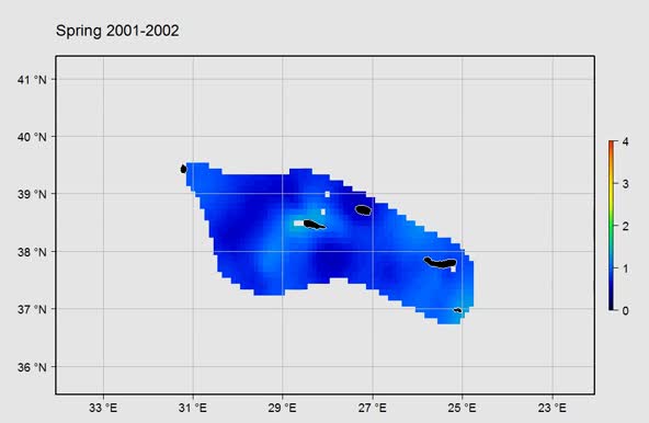
Gridded abundance maps of marine birds around the Azores Citation Flanders Marine Institute (VLIZ); Royal Netherlands Institute for Sea Research (NIOZ); (2015): Gridded abundance maps of marine birds around the Azores; European Marine Observation Data Network (EMODnet) Biology project (www.emodnet-biology.eu), funded by the European Commission’s Directorate - General for Maritime Affairs and Fisheries (DG MARE). https://marineinfo.org/id/dataset/5459 Contact: Availability:  This dataset is licensed under a Creative Commons Attribution-NonCommercial-ShareAlike 4.0 International License. This dataset is licensed under a Creative Commons Attribution-NonCommercial-ShareAlike 4.0 International License.Pictures (2) Description Gridded abundance map of marine birds around the Azores. This product was developed with DIVA (Data-Interpolating Variational Analysis). Data was provided by the Azores Fisheries Observation Programme (POPA). more This dataset is based on: Machete, M.; Institute of Marine Research (IMAR), Portugal; Department of Oceanography and Fisheries, University of the Azores (DOP/UAC), Portugal; (2014): POPA- Fisheries Observer Program of the Azores: Seabird sightings in the Azores tuna fishery from 1998 to 2013: during the capture of live bait. http://dx.doi.org/10.14284/10 Machete, M.; Institute of Marine Research (IMAR), Portugal; Department of Oceanography and Fisheries, University of the Azores (DOP/UAC), Portugal; (2014): POPA- Fisheries Observer Program of the Azores: Seabird sightings in the Azores tuna fishery from 1998 to 2013: while fishing. http://dx.doi.org/10.14284/12 Machete, M.; Institute of Marine Research (IMAR), Portugal; Department of Oceanography and Fisheries, University of the Azores (DOP/UAC), Portugal; (2016): POPA- Fisheries Observer Program of the Azores: Seabird sightings in the Azores tuna fishery from 2000 on: during navigation or search mode. http://dx.doi.org/10.14284/11 Scope Themes: Biology > Birds Keywords: Marine/Coastal, Analysis, Biota, Coordinate reference systems, Data not evaluated, Geoscientific Information, Interpolated mapping, Metadata not evaluated, NetCDF (Network Common Data Form), No limitations to public access, Oceans, Regional, WGS84 (EPSG:4326), ANE, Azores, Calonectris diomedea (Scopoli, 1769), Larus cachinnans Pallas, 1811 Geographical coverage ANE, Azores [Marine Regions] Temporal coverage 2000 - 2009 Contributors Related datasets Source datasets: POPA- Fisheries Observer Program of the Azores: Seabird sightings in the Azores tuna fishery from 1998 to 2013: during the capture of live bait, more POPA- Fisheries Observer Program of the Azores: Seabird sightings in the Azores tuna fishery from 1998 to 2013: while fishing, more POPA- Fisheries Observer Program of the Azores: Seabird sightings in the Azores tuna fishery from 2000 on: during navigation or search mode, more URLs Dataset information: Other: Dataset status: Completed Data type: Data products Data origin: Monitoring: field survey Metadatarecord created: 2016-10-07 Information last updated: 2024-12-04 | ||||


