A new integrated search interface will become available in the next phase of marineinfo.org.
For the time being, please use IMIS to search available data
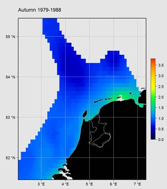
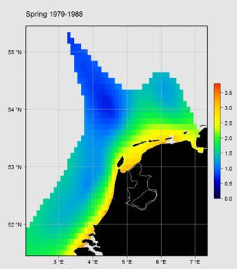
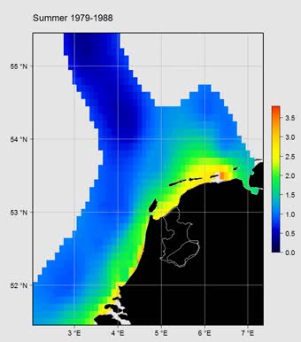
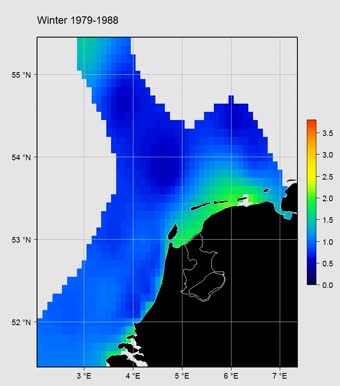
Gridded abundance maps of chlorophyll a around the Dutch coast Citation Flanders Marine Institute (VLIZ); Royal Netherlands Institute for Sea Research (NIOZ); (2015): Gridded abundance maps of chlorophyll a around the Dutch coast; European Marine Observation Data Network (EMODnet) Biology project (www.emodnet-biology.eu), funded by the European Commission’s Directorate - General for Maritime Affairs and Fisheries (DG MARE). https://marineinfo.org/id/dataset/5462 Contact: Availability:  This dataset is licensed under a Creative Commons Attribution-NonCommercial-ShareAlike 4.0 International License. This dataset is licensed under a Creative Commons Attribution-NonCommercial-ShareAlike 4.0 International License.Pictures (4) Description Gridded abundance product representing chlorophyll-a values in the Dutch North Sea from 1976 till 2014. Chlorophyll –a can be interpreted as a proxy for phytoplankton. The resulting values vary seasonally. The winter concentrations are lower because low light and temperature are not optimal for phytoplankton growth. In spring we observe the highest concentrations occurring in near coastal waters where nutrients from rivers are most abundant. Phytoplankton organisms are responsible for about 45% of annual global photosynthesis. They are as such vital for the functioning of marine food webs (considered in MSFD descriptor 4) and are the main drivers of the global biogeochemical cycles. This product was developed with DIVA (Data-Interpolating Variational Analysis) and the scale is log-transformed abundance (in µg per liter). Data was provided by Rijkswaterstaat (RWS). Scope Themes: Biology > Pigments (e.g. chlorophyll), Biology > Plankton > Phytoplankton Keywords: Marine/Coastal, Coordinate reference systems, Data not evaluated, Environment, Geoscientific Information, Interpolated mapping, Metadata not evaluated, National, NetCDF (Network Common Data Form), No limitations to public access, Oceans, WGS84 (EPSG:4326), ANE, Netherlands, Dutch Continental Shelf Geographical coverage ANE, Netherlands, Dutch Continental Shelf [Marine Regions] Temporal coverage 1976 - 2014 Contributors Publication Used in this dataset Baretta-Bakker, J.G. et al. (2009). Description of the long-term (1991–2005) temporal and spatial distribution of phytoplankton carbon biomass in the Dutch North Sea. J. Sea Res. 61(1-2): 50-59. https://dx.doi.org/10.1016/j.seares.2008.10.007, more URLs Dataset information: Other: Dataset status: Completed Data type: Data products Data origin: Monitoring: field survey Metadatarecord created: 2016-10-07 Information last updated: 2024-12-04 | ||||


